Fürstenberg Nord

Germany, Baden-Württemberg, Fürstenberg, 850m (AMSL) |SHOW ON MAP|
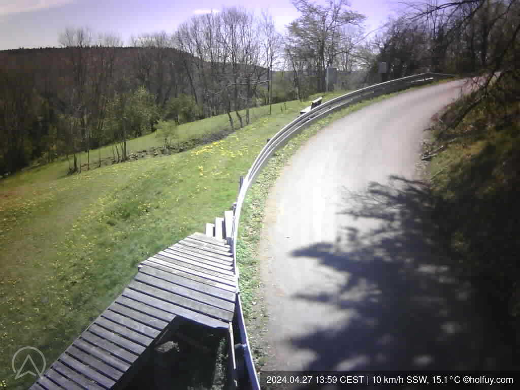
Fürstenberg Nord-Ost Startplatz
Info(youknowit)baar-flieger.de
06:05-20:58 (CEST)
Bitte die Auflagen zum Flugbetrieb in der Satellitenzone Süd der RMZ-EDTD Donaueschingen beachten.
Weitere Informationen zum Fluggebiet Fürstenberg Nord unter
http://baar-flieger.de/fluggebiet-fuerstenberg-nord-ost/
Fürstenberg Nord-Ost Startplatz
Info(youknowit)baar-flieger.de
06:05-20:58 (CEST)
Bitte die Auflagen zum Flugbetrieb in der Satellitenzone Süd der RMZ-EDTD Donaueschingen beachten.
Weitere Informationen zum Fluggebiet Fürstenberg Nord unter
http://baar-flieger.de/fluggebiet-fuerstenberg-nord-ost/
Page views in 2026: 81027
Note: Calculated from yearly data where the average wind speed is more than 4km/h.
Loading...
Averages updated: 02:52:44 Mon CEST
| Time | 19h | 19:15 | 19:30 | 19:45 | 20h | 20:15 | 20:30 | 20:45 | 21h | 21:15 | 21:30 | 21:45 | 22h | 22:15 | 22:30 | 22:45 | 23h | 23:15 | 23:30 | 23:45 | Mon | 00:15 | 00:30 | 00:45 | 01h | 01:15 | 01:30 | 01:45 | 02h | 02:15 | 02:30 | 02:45 |
| Speed | 4 | 4 | 6 | 3 | 5 | 7 | 7 | 8 | 8 | 9 | 11 | 8 | 11 | 11 | 11 | 12 | 14 | 16 | 16 | 17 | 18 | 17 | 15 | 15 | 13 | 10 | 10 | 8 | 8 | 8 | 7 | 3 |
| Gust (km/h) | 15 | 13 | 19 | 11 | 13 | 14 | 17 | 14 | 15 | 14 | 17 | 16 | 22 | 20 | 27 | 20 | 23 | 25 | 26 | 29 | 28 | 25 | 26 | 25 | 27 | 23 | 20 | 16 | 19 | 15 | 15 | 15 |
| Direction | ||||||||||||||||||||||||||||||||
| Direction Deg. | S 189° | SSW 197° | S 182° | S 169° | S 177° | S 178° | S 177° | S 169° | S 180° | S 171° | SSE 160° | SE 144° | SE 132° | ESE 114° | SE 124° | SE 129° | SE 142° | SE 134° | SE 139° | SE 131° | SE 132° | ESE 119° | SE 131° | SE 137° | SE 146° | SE 136° | SE 130° | ESE 122° | SE 125° | SE 130° | ESE 114° | ENE 60° |
| Humidity (%) | 55.6 | 56.2 | 55.4 | 56.1 | 56.5 | 56.4 | 58.3 | 59.9 | 60.8 | 61.3 | 60.8 | 61.7 | 65.0 | 65.5 | 66.0 | 66.0 | 65.9 | 66.8 | 67.7 | 67.5 | 67.9 | 68.9 | 69.7 | 69.6 | 68.7 | 68.4 | 69.4 | 68.9 | 68.9 | 67.8 | 66.8 | 68.7 |
| Rain (mm) | - | - | - | - | - | - | - | - | - | - | - | - | - | - | - | - | - | - | - | - | - | - | - | - | - | - | - | - | - | - | - | - |
| Temp. (°C) | 26.1 | 25.9 | 25.9 | 25.8 | 25.6 | 25.7 | 25.4 | 25.2 | 25.0 | 24.8 | 25.1 | 24.9 | 24.4 | 24.3 | 24.1 | 24.1 | 24.1 | 23.9 | 23.6 | 23.6 | 23.5 | 23.3 | 23.3 | 23.7 | 23.8 | 23.6 | 23.1 | 23.2 | 23.1 | 23.2 | 23.1 | 22.5 |
| Time | 11h | 12h | 13h | 14h | 15h | 16h | 17h | 18h | 19h | 20h | 21h | 22h | 23h | Sun | 01h | 02h | 03h | 04h | 05h | 06h | 07h | 08h | 09h | 10h | 11h | 12h | 13h | 14h | 15h | 16h | 17h | 18h |
| Speed | 5 | 3 | 2 | 3 | 5 | 7 | 12 | 10 | 10 | 11 | 7 | 9 | 7 | 8 | 8 | 7 | 6 | 7 | 6 | 6 | 8 | 7 | 10 | 11 | 11 | 11 | 8 | 9 | 8 | 6 | 7 | 6 |
| Gust (km/h) | 13 | 13 | 11 | 13 | 19 | 22 | 28 | 22 | 20 | 19 | 14 | 20 | 20 | 21 | 23 | 20 | 14 | 14 | 14 | 19 | 17 | 19 | 17 | 26 | 26 | 27 | 22 | 21 | 23 | 17 | 20 | 19 |
| Direction | ||||||||||||||||||||||||||||||||
| Direction Deg. | SE 139° | S 186° | SSW 197° | SSW 195° | ENE 60° | NNE 18° | N 355° | N 6° | N 354° | N 356° | NNE 26° | SE 125° | ESE 105° | E 92° | SE 135° | ENE 73° | N 0° | NNW 346° | N 2° | NNW 339° | NNW 331° | NNW 330° | N 7° | NNE 20° | NNE 21° | NNE 27° | NE 51° | ESE 103° | ESE 110° | ESE 103° | ESE 108° | SSE 163° |
| Humidity (%) | 80.6 | 87.9 | 89.7 | 84.8 | 74.4 | 67.5 | 64.8 | 61.2 | 63.4 | 64.1 | 66.7 | 72.8 | 75.5 | 73.9 | 71.4 | 73.5 | 79.4 | 83.8 | 87.1 | 91.8 | 93.8 | 90.7 | 84.7 | 76.7 | 74.5 | 71.4 | 67.5 | 65.5 | 61.7 | 59.5 | 57.1 | 54.6 |
| Rain (mm) | - | 0.9 | 0.1 | - | - | - | - | - | - | - | - | - | - | - | - | - | - | - | - | - | - | - | - | - | - | - | - | - | - | - | - | - |
| Temp. (°C) | 22.2 | 20.4 | 19.3 | 20.6 | 22.7 | 23.7 | 23.8 | 24.1 | 23.4 | 22.8 | 22.3 | 21.3 | 20.2 | 20.0 | 19.7 | 19.2 | 18.0 | 17.2 | 17.0 | 16.2 | 15.8 | 16.5 | 18.3 | 20.1 | 21.1 | 22.1 | 23.7 | 24.6 | 25.3 | 25.9 | 26.2 | 26.5 |
Graphs
ZOOM
3 h
6 h
12h
1 d
5 d(max)
Synchronized zoom
updated: 02:52:44 Mon CEST
- Wind speed (km/h)
- Wind direction (°deg)
- Temperature & Dew Point (°C)
- Humidity (%)
Scroll down or click here to load graphs.
Scroll down or click here to load graphs.
Scroll down or click here to load graphs.
Scroll down or click here to load graphs.
- Light
Scroll down or click here to load graphs.
- Rain(mm)
Scroll down or click here to load graphs.
- Standard Pressure (hPa)
Scroll down or click here to load graphs.