Tinto

Scotland,Tinto Hill, 423m (AMSL) |SHOW ON MAP|
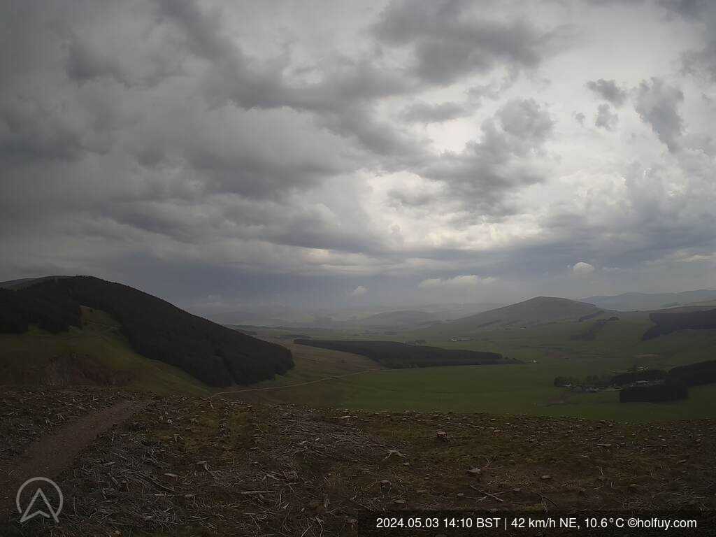
Tinto paragliding. Between Howgate hill and Lochlyoch Hill.
https://www.llsclub.co.uk/index.php/sites
05:14-21:28 (BST)
Large open hill with 4km ridge running east to west. Site may be flown either North or South. Check LLSC website for airspace restrictions, site details and precautions. The weather station is situated on the summit of a gently rounded hill approximately 1km west of the usual launch point which is now clear of trees and should give reliable wind indications from all directions. Data should be treated with caution and visitors should satisfy themselves that it is safe to fly.
Page views in 2026: 17058
Note: Calculated from yearly data where the average wind speed is more than 4km/h.
Loading...
Averages updated: 01:38:16 Tue BST
| Time | 17:45 | 18h | 18:15 | 18:30 | 18:45 | 19h | 19:15 | 19:30 | 19:45 | 20h | 20:15 | 20:30 | 20:45 | 21h | 21:15 | 21:30 | 21:45 | 22h | 22:15 | 22:30 | 22:45 | 23h | 23:15 | 23:30 | 23:45 | Tue | 00:15 | 00:30 | 00:45 | 01h | 01:15 | 01:30 |
| Speed | 26 | 21 | 18 | 18 | 18 | 24 | 24 | 23 | 19 | 18 | 17 | 17 | 16 | 14 | 14 | 16 | 14 | 13 | 13 | 13 | 11 | 11 | 13 | 15 | 15 | 17 | 19 | 20 | 18 | 16 | 19 | 18 |
| Gust (km/h) | 35 | 32 | 26 | 27 | 28 | 37 | 35 | 34 | 28 | 25 | 25 | 23 | 21 | 20 | 19 | 22 | 19 | 20 | 21 | 22 | 17 | 19 | 19 | 20 | 20 | 28 | 26 | 25 | 25 | 21 | 25 | 22 |
| Direction | ||||||||||||||||||||||||||||||||
| Direction Deg. | WSW 243° | WSW 243° | WSW 256° | W 261° | W 260° | WSW 252° | WSW 256° | WSW 256° | WSW 257° | WSW 256° | WSW 251° | SW 236° | WSW 241° | WSW 240° | SW 231° | SW 231° | SW 216° | SSW 202° | SSW 196° | SSW 210° | S 188° | SSW 202° | SSW 209° | SW 218° | SW 215° | SSW 203° | SSW 207° | SSW 204° | SSW 198° | SSW 192° | SSW 198° | S 189° |
| Humidity (%) | 93.2 | 93.4 | 94.0 | 92.9 | 92.3 | 90.0 | 89.2 | 89.2 | 88.7 | 88.9 | 88.9 | 89.6 | 89.2 | 90.4 | 90.8 | 89.6 | 89.8 | 90.6 | 91.0 | 89.3 | 90.8 | 90.9 | 91.8 | 94.7 | 96.4 | 97.2 | 97.6 | 97.9 | 98.1 | 98.2 | 98.3 | 98.5 |
| Temp. (°C) | 13.1 | 13.3 | 13.3 | 13.5 | 13.6 | 13.9 | 13.8 | 13.8 | 13.9 | 13.8 | 13.7 | 13.6 | 13.6 | 13.5 | 13.4 | 13.5 | 13.4 | 13.2 | 13.1 | 13.3 | 13.1 | 13.2 | 13.3 | 13.2 | 13.2 | 13.2 | 13.4 | 13.4 | 13.4 | 13.5 | 13.5 | 13.6 |
| Time | 10h | 11h | 12h | 13h | 14h | 15h | 16h | 17h | 18h | 19h | 20h | 21h | 22h | 23h | Mon | 01h | 02h | 03h | 04h | 05h | 06h | 07h | 08h | 09h | 10h | 11h | 12h | 13h | 14h | 15h | 16h | 17h |
| Speed | 25 | 23 | 26 | 28 | 29 | 29 | 31 | 29 | 30 | 25 | 24 | 24 | 21 | 27 | 23 | 23 | 19 | 17 | 17 | 17 | 19 | 17 | 14 | 13 | 18 | 19 | 24 | 25 | 28 | 27 | 25 | 22 |
| Gust (km/h) | 40 | 38 | 43 | 52 | 45 | 45 | 47 | 46 | 44 | 39 | 38 | 38 | 31 | 39 | 33 | 32 | 28 | 27 | 28 | 25 | 29 | 28 | 22 | 26 | 31 | 31 | 41 | 40 | 45 | 41 | 41 | 37 |
| Direction | ||||||||||||||||||||||||||||||||
| Direction Deg. | WNW 294° | WNW 301° | WNW 298° | WNW 298° | WNW 287° | WNW 294° | WNW 293° | WNW 292° | WNW 293° | WNW 296° | WNW 295° | WNW 302° | NW 313° | NW 309° | NW 305° | WNW 291° | WNW 293° | WNW 290° | W 280° | WNW 289° | WNW 282° | W 278° | W 265° | WSW 246° | WSW 258° | W 261° | WSW 243° | WSW 250° | WSW 246° | WSW 252° | WSW 244° | WSW 243° |
| Humidity (%) | 99.2 | 98.9 | 95.5 | 88.7 | 84.7 | 85.3 | 86.0 | 87.2 | 88.1 | 87.8 | 88.0 | 89.9 | 90.6 | 91.2 | 92.3 | 93.2 | 92.7 | 93.3 | 92.8 | 91.4 | 93.2 | 92.3 | 90.2 | 89.9 | 91.1 | 95.0 | 93.5 | 88.5 | 85.7 | 87.6 | 91.8 | 94.5 |
| Temp. (°C) | 12.0 | 12.2 | 12.2 | 13.4 | 14.1 | 14.0 | 13.5 | 13.1 | 13.0 | 12.9 | 12.7 | 12.2 | 11.6 | 10.8 | 10.2 | 9.6 | 9.4 | 9.0 | 9.1 | 9.3 | 9.2 | 9.5 | 10.3 | 11.0 | 11.3 | 11.2 | 11.4 | 12.3 | 13.3 | 13.1 | 12.9 | 12.8 |
Graphs
ZOOM
3 h
6 h
12h
1 d
5 d(max)
Synchronized zoom
updated: 01:38:16 Tue BST
- Wind speed (km/h)
- Wind direction (°deg)
- Temperature & Dew Point (°C)
- Humidity (%)
Scroll down or click here to load graphs.
Scroll down or click here to load graphs.
Scroll down or click here to load graphs.
Scroll down or click here to load graphs.
- Standard Pressure (hPa)
Scroll down or click here to load graphs.